
Clarence Webb and Hiram F. Gregory.
The Caddo Indians of Louisiana.
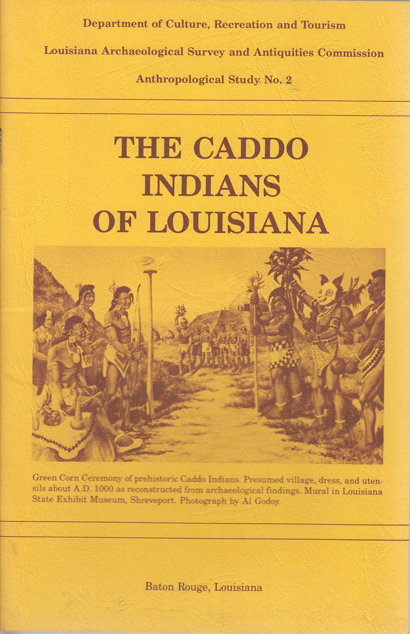
Department of Culture, Recreation and Tourism
Louisiana Archaeological Survey and Antiquities Commission
Anthropological Study No. 2

INDIANS
OF LOUISIANA

By
Clarence Webb
and
Hiram F. Gregory
Second Edition,
Second Printing March 1990
Baton Rouge, Louisiana
- State Archaeologist’s Note
- Introduction
- Pre-Caddoan Development
- Early Caddo Culture: Alto Focus
- Bossier Focus
- Belcher Focus
- Historic Caddo
- European Contact
- Caddoan Tribal Locations and Archaeology in Louisiana
- Caddoan Heritage
- References Cited

State Archaeologist’s Note
Louisiana’s cultural heritage dates back to approximately 10,000 B.C. when man first entered this region. Since that time, many other Indian groups have settled here. All of these groups, as well as the more recent whites and blacks, have left evidence of their presence in the archaeological record. The Anthropological Study series published by the Department of Culture, Recreation and Tourism, Office of Cultural Development, Division of Archaeology, provides a readable account of various activities of these cultural groups.
This booklet, The Caddo Indians of Louisiana, was originally published in 1978 and was the second volume in the Anthropological Study series. The demand for this booklet proved so great that by 1982 it was out of print. For the last three years the Division of Archaeology has received so many requests for this volume that it is now being reissued. The present volume is virtually identical to the previous one with the exception of the illustrations.
Clarence H. Webb, a well-known Shreveport physician and a pioneer in Caddoan studies and Hiram F. Gregory, a professor at Northwestern State University, are the authors of this volume. Combined, they have spent over six decades studying the Indian cultures of the northwestern part of the state. The present volume summarizes a portion of their work in this area. It describes the various prehistoric cultures that were present in this part of Louisiana but concentrates on the Caddo cultural manifestations. It also discusses the Indians’ early interaction with European explorers, traders, and missionaries. The archaeological remains of several of the historic Caddo groups are also described.
We are pleased once again to make this booklet available to the people of the state. We trust the reader will enjoy this volume.
Kathleen Byrd

Introduction
Northwestern Louisiana was occupied by the Caddo Indians during the period of early Spanish, French, and American contacts. By combining history and archaeology, the Caddo story can be traced back for a thousand years — a unique opportunity made possible by a long tradition of distinctive traits, especially in pottery forms and decorations. Our story of the Caddo Indians in Louisiana, therefore, begins around A.D. 800-900 and can be traced by archaeology well into the historic period.
The center of Caddoan occupation during contact times and throughout their prehistoric development was along Red River and its tributaries, with extensions to other river valleys in the four-state area of northern Louisiana, southwestern Arkansas, eastern Texas, and eastern Oklahoma. The successful agriculture of these farming peoples was best adapted to the fertile valleys of major streams like the Red, Sabine, Angelina, Ouachita and — in Oklahoma — the Canadian and Arkansas rivers.
In spite of their linguistic (language) connections with Plains tribes like the Wichita, Pawnee, and Ankara, the Caddos in Louisiana had customs much like those of other Southeastern tribes. They maintained trade and cultural contacts with the lower Mississippi Valley tribes of eastern and southern Louisiana for many centuries.

Pre-Caddoan Development
Northwestern Louisiana was occupied for thousands of years before the beginnings of Caddo culture. In the upland areas, along small streams and bordering the river valleys, projectile points and tools of early and late Paleo-Indian peoples have been found (Webb 1948b; Gagliano and Gregory 1965). In the western plains, the makers of the fluted Clovis and Folsom points hunted now extinct types of big game (mammoth, mastodon, sloth) between 10,000 and 8000 B.C. The later Plainview, Angostura, and Scottsbluff points have been found with the extinct large bison. Since all of these distinctive projectile point types have been found in the Louisiana uplands and mastodon bones, teeth, and tusks have been found in Red River Valley, big game hunting was possible in the state. However, no camp or kill sites of Paleo-Indian people have been found thus far.
The oldest camp sites in the Caddo area of northwestern Louisiana are those of the San Patrice culture, thought to date between 8000 and 6000 B.C. This culture, which some students look upon as late Paleo-Indian and others as early Archaic, was named for a stream in De Soto and Sabine parishes (Webb 1946). When a camp site of two bands of San Patrice people was excavated south of Shreveport (Webb, Shiner and Roberts 1971), only their typical points and a variety of small scraping, cutting, and drilling stone tools were found. The tools indicated that they still depended largely on hunting — probably deer bear, bison, and smaller animals — with a gradual increase in reliance on gathering wild plant foods. Stone points and tools of San Patrice people have been found over much of the terrace and upland parts of Louisiana.
A combination of hunting, fishing, and gathering of native foods by bands of people, whom we call Archaic (Meso-Indian), was characteristic throughout Louisiana from 6000 B.C. until almost the time of Christ. In favorable locations they congregated in larger groups, at least during certain times of the year, but did not form definite year-round settlements. Grinding stones and pitted nut stones show that Archaic people harvested seeds and nuts, such as hickory nuts, walnuts, pecans, acorns, and chinquapins (chestnuts). They also made ground stone celts (hatchets) or grooved axes for wood cutting and polished stone ornaments, especially beads. They hunted with darts which are heavier than arrows and were thrown with the atlatl, or throwing stick.
Toward the end of the long Archaic period, by 1500 B.C., the Poverty Point culture developed in northeastern, central, and southern Louisiana. Sites of this culture have not been found on Red River, but there are Poverty Point sites on the Ouachita River and the late Archaic people on Red River had a few items — soapstone vessels, hematite plummets or bolas weights, polished or effigy beads — which may have been traded from Poverty Point.
People who lived in small settlements and made pottery appeared in the area about the time of Christ. Their crude pottery was generally plain and resembled that of Fourche Maline people in eastern Oklahoma and southwestern Arkansas. In northwestern Louisiana, the culture is called Bellevue Focus, named for a small mound site on Bodcau Bayou near Bellevue, in Bossier Parish (Fulton and Webb 1953). The small conical Bellevue mound was found to cover flexed and partly cremated burials, and is thought to represent the beginning of the trait of building mounds as burial commemorations in this part of the state. There was no sign of cultivated plants, although the Marksville people of this time may have grown maize (corn) and squash. Probably, the Bellevue people lived largely as had the Archaic folk, by hunting, fishing, and gathering the abundant native foods. At another half dozen small sites along the Red River Valley margins and on the lateral lakes, small conical mounds show a culture like that of Bellevue. One of these in Caddo Parish also had polished stone and native copper beads with cremated burials. An occasional decorated pottery sherd found at these Bellevue sites resembles Marksville and Troyville pottery of the lower Mississippi Valley.
The Fredericks mound and village site, near Blaack Lake in Natchitoches Parish, seems to be an outpost or colony of central Louisiana Marksville and Troyville cultures, probably inhabited between A.D. 100 and 600. A few scattered sherds at other sites along Red River show a thin occupation or trade with Marksville, but Fredericks is the only large mound and village site of this intrusive culture in the area. The smaller Coral Snake mound on Sabine River, west of Natchitoches, has burial offerings of Marksville types.
The first widespread occupation of northwestern Louisiana by pottery making, farming people was that of Coles Creek culture. This culture developed along the lower Mississippi Valley, in Louisiana and Mississippi, including the lower Red River, starting about A.D. 700. Probably because their agriculture was more advanced, Coles Creek populations increased and spread widely, up the Mississippi Valley, throughout northern Louisiana, eventually into the Caddoan area of the other three states, and even to the Arkansas River in central Arkansas and eastern Oklahoma.
Coles Creek hamlets and villages were on the riverbanks, on the lateral lakes, and on streams in the uplands. Many settlements were larger than in previous times and large ceremonial centers evolved, some of which featured mounds around a central plaza. There probably were temples atop the flat-topped mounds and burials within other mounds. The temples were either chiefs’ or priests’ lodges, or sacred temples, and ceremonies and festivals presumably were held in the plazas. Pottery was well made and hunting was with the bow and arrow which replaced the atlatl and dart in this area about A.D. 600.

Early Caddo Culture: Alto Focus
At some time before A.D. 1000, and probably by A.D. 800, the traits associated with the beginnings of prehistoric Caddo culture replaced Coles Creek over the four-state area. The change may have started along Red River in northwestern Louisiana, although others have thought that a group of “culture bearers” entered the Caddoan area of eastern Texas overland from the more advanced culture centers of the Mexican Highlands.
Whether the ideas that are shown in the prehistoric settlements came overland or up the rivers, two conclusions seem certain:
- early Caddoan culture existed for a time with late Coles Creek; and
- Caddo beginnings added new customs and traits that seem to have originated in Middle America, especially in the Mexican Highlands and on the upper Mexican Gulf Coast.
The early Caddo unquestionably derived many things from Coles Creek. Their settlement patterns were similar, a culture change from Coles Creek to Caddo often occurring in the same village or even in building levels of the same mound. The Caddo continued bow and arrow hunting, with identical or slightly changed stone arrow points. Coles Creek and Caddo peoples practiced the same kind of intensive maize-beans-sunflower-squash-pumpkin agriculture or horticulture. They both made clay or stone effigy pipes and smoked tobacco ceremonially. The Caddo shared many of the Coles Creek pottery types, especially in the utility vessels, with minor changes taking place through time, as is to be expected. The Caddo retained strong religious and civil authority in the villages and the major ceremonial centers and were organized under a chieftain type of authority. There are similarities to Coles Creek, finally, in Caddoan ceremonial festivities, games, and customs of burying the dead in mounds alongside the plazas.
A Middle American origin can be assumed for a number of Caddoan ceramic ideas. The bottle and the carinated bowl — a bowl with a sharp angle separating the rim from the sides or the base — vessel shapes are likely Mexican introductions. The same is true of the low-oxygen firing of pottery and the burnishing or polishing of the exterior to produce glossy mahogany brown or black surfaces. Decoration of these surfaces was often by engraving after firing, combined with cut-out areas and insertion of red pigment into the designs, and the frequent use of curved line rather than straight line designs. The curved motifs included concentric circles, spirals, scrolls, interlocking scrolls, meanders, volutes, swastikas, and stylized serpent designs. A few curvilinear designs were present in the earlier Marksville and Coles Creek pottery, but they became more varied and frequent in Caddoan ceramics.
Another trait introduced from Middle America was that of placing burials of important people, such as chiefs, priests, and family members of the ruling class, in shaft graves, sunk into mounds or special cemetery areas. Some of the more important early Caddo tombs are quite large, as much as 15 to 20 feet in length and 8 to 16 feet in depth. Many had special sands or pigments on the pit floor, numerous offerings, and indications that retainers or servants were sacrificed to accompany the revered person in the afterlife. Shaft tombs in mounds and pyramids occurred in the Maya areas of Guatemala and Yucatan, and also in the Mexican Highlands, before and during the time of the early Caddos.
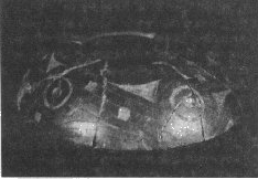
Other Mexican traits were the concepts of the long-nosed god and
the feathered serpent. These symbols are seen in the Caddo area in
sheet copper masks, on carved stone pipes, and on carved conch
shells.
In Middle America, the long-nosed god symbol relates to the
worship of
the rain god, Chaac, and the feathered serpent is the symbol of
Quetzalcoatl (Kukulcan in Maya).
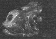
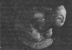
Courtesy of Louisiana State Exhibit Museum.
Photographs from Pictures of Records, Inc.
Signs of elaborate ceremonialism have been found in large Caddoan mound groups or centers in each of the four states: Davis, Sanders, and Sam Kaufman sites in Texas; Spiro and Harlan in Oklahoma; Crenshaw, Mineral Springs, Ozan, and East mounds in Arkansas. Along Red River in northwestern Louisiana, the well-known early Caddo centers are Gahagan and Mounds Plantation.
The Gahagan site is on the west side of Red River, almost equidistant between Natchitoches and Shreveport. Formerly it was situated on an old channel but much of the channel and site have been destroyed by river caving. A village area, a conical burial mound, and a small flat-topped mound surrounded a large plaza at Gahagan. Another small mound is about a quarter mile distant. The burial mound was excavated by Clarence B. Moore in 1912, and by Webb and Dodd (1939). Moore described a central shaft, 11 feet in depth and 13 by 8 feet in dimensions, with five burials and more than 200 offerings. Webb and Dodd found two additional pits along the slopes, both starting at the mound surface and terminating near the base. They were 19 by 15 and 12 by 11 feet in dimensions, and contained six and three burials, respectively. Between 250 and 400 offerings were preserved in each pit.
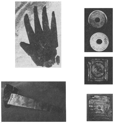
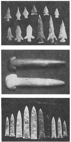
The burial offerings at Gahagan included ornate pottery, beautifully flaked stone knives (called Gahagan blades), batches of choice flint arrow points, long-stemmed or figurine pipes of clay and stone, copper-plated ear ornaments, sheet copper plaques, copper hand effigies, long-nosed god copper masks, polished greenstone celts (some spade-shaped), bone hairpins, and shell beads or ornaments. All of these are unusual for this area and show that the early Caddos had widespread trade channels for these esoteric objects and materials. The sources are as distant as the Gulf Coast, the Kiamichi Mountains of Oklahoma, the central Texas plateau, Tennessee or Kentucky, and, possibly, the Great Lakes area.
The second Caddo site where high ceremonialism existed is at Mounds Plantation, on an old Red River channel just north of Shreveport. An oval plaza, more than 600 yards in length and 200 yards in width (about 25 acres), is surrounded by seven mounds of varying sizes, with two smaller mounds at some distance. It was first described by Clarence B. Moore (1912), then studied by surface collections and limited excavations by Relph R. McKinney, Rebert Plants, and Clarence H. Webb, with assistance of friends (Webb and McKinney 1975). At least four culture periods were indicated by pottery sherds. Excavations proved that Coles Creek people established and laid out the site, probably constructing at least four of the mounds around the plaza. A flat mound on the northwest corner; started by these people, was built higher by the early Caddos in what seems to have been a period of rapid culture change. The mound may have been the location of an arbor or lodge where food was prepared and served during festivals or ceremonies held in the adjoining plaza.
Courtesy of Louisiana State Exhibit Museum.
Photographs from Pictures of Record, Inc.
At the southeast end of the plaza, the Coles Creek people prepared a large burial pit, measuring 16 by 14 feet, in which they placed 10 adult or adolescent burials in two parallel rows. Offerings found by the investigators were limited to flint arrow points, bone pins, smoothing stones, traces of copper-plated ear ornaments, and ankle rattles of tortoise shells filled with pebbles. A small mound had been built over this pit, and into this mound later Coles Creek burials has been placed.
Subsequently, the Alto Caddos also used this mound for burials, digging four large shaft tombs and three smaller pits. All but one of these features contained offerings of superior quality. The most spectacular of the graves was a large crater-shaped pit adjoining the Coles Creek pit. It was 19 by 17 feet in dimensions, and was cut through the mound to a depth of 4 feet below its base. In it were the skeletons of 21 persons, from elderly adults to unborn infants. An adult male, 6 feet tall, was provided with numerous personal effects which included a sheathed knife on his left forearm and a well-preserved 5112 foot bow of bois d’arc wood placed by his left side. He is thought to have been the paramount person whose death occasioned the immense tomb, the ceremonial offerings, and the presumed sacrifice of tribal members to accompany him in the afterlife. Part of the tomb was covered with a framework of cedar logs, thus accounting for the unusual preservation of many cane and wooden objects.
Preserved offerings included an ornate pottery bowl, decorated with a thumb-finger cross and eye symbols, flint knives of Gahagan type, 53 arrow points, a long-stemmed pipe, copper-plated ear ornaments, puma teeth, and objects of wood which included knife handles, a comb, a baton, several small bows, and wooden frames. Also present were leather, plaited cording or twine, and about 200 fragments of split cane woven mats, some of them with diamond or bird head designs. A half pint of seeds beside the important male were identified later as purslane (Portulaca oleracea), a plant sometimes used for food by aboriginal people. Also beside the male were four objects typical of Poverty Point or late Archaic manufacture: two long polished stone beads, a polished hematite plummet, and half of a perforated slate gorget. These ancient objects from a time 2,000 years before the Caddo burial occurred, must have been found and kept as venerated talismans by the Caddo leaders.
Radiocarbon dates from logs in the Caddo tomb at Mounds Plantation indicated a time between A.D. 1000 and 1100. In 1983 a prehistoric cypress dugout canoe, 30 feet in length, was found beneath the bank of Red River only three miles north of Mounds; its radiocarbon dating is of the same century.
Gahagan and Mounds Plantation have their counterparts as early Caddoan ceremonial and trade centers at a dozen similar large sites in Texas, Oklahoma, and Arkansas. The best known is the Spiro mound center on the Arkansas River in eastern Oklahoma, where enormous amounts of well-made and exotic objects from the entire midportion of the United States were gathered or made as offerings. Close contact between these large ceremonial centers is shown by the similarity of objects, materials, or artistic concepts across the entire Caddo area. Contacts with other cultural centers in the Mississippi Valley and into the Southeast also are seen.
Contrasting with these important centers, with their reflection of Middle American ceremonialism, organized religio-civil leadership class, and expensive cruel burial ceremonies, there were many small villages and hamlets of early Caddo people. Their habitations, tools, and some customs are known by explorations of sites at Smithport Landing (Webb 1963), Allen, Wilkinson, Swanson’s Landing, and Harrison’s Bayou along the western valley escarpment (Ford 1936; Webb and McKinney 1975; Gregory and Webb 1965), Colbert and Greer sites on upland streams in Bienville Parish, and the recent study of a hamlet at Hanna on the Red River below Gahagan (Thomas, Campbell and Ahler 1977).
Many other small settlements of this time are known but have not been studied, 30 to 40 altogether between Natchitoches and the Arkansas state line (Thomas, Campbell and Ahler 1977; Webb 1975). They are found in the Red River Valley, on lateral lakes and streams, and in the uplands. Apparently, these were simple farming, gathering, hunting, and fishing folk who did not share in the exotic materials of the complex regional centers. They probably did participate in ceremonies, festivities, and renewals of faith by visits to the centers and may have provided food, local materials, and occasional manpower in exchange for leadership and protection. For the next 500 years there is no evidence of the Caddo being threatened by outsiders.

Bossier Focus
Between A.D. 1100 and 1200 the early Caddo culture was changing into a simpler culture that has been named Bossier; for the parish in which it was first discovered (Webb 1948a). The large centers faded out or were inhabited by small groups. The people seem to have been secure, not menaced, and beginning to spread out along the streams in small settlements or family homesteads. Local materials were used and few exotic objects have been found. Burial customs became simpler; usually single graves with a few offerings and situated near the home or in small cemeteries. The pottery of the Bossier folk was of good quality and still had some of the decoration by engraving, incising, and punctating techniques of the earlier period, but increasing amounts of everyday wares were decorated by simple brushing (similar to Plaquemine pottery of eastern and southern Louisiana).
Between Caddo Lake and Natchitoches the location of settlements in the Red River Valley almost disappeared at this time, possibly signifying the beginning of the Great Raft. The villages and hamlets were on the lateral streams, lakes, and into the uplands, along virtually every watercourse. A calm period of pastoral life is indicated and probably lasted until it was shattered in 1542 by Moscoso’s tattered Spanish army and the subsequent arrival of other Europeans.
One such hamlet or family homestead of Bossier people was at the
Montgomery site in upper Webster Parish at the Springhill Airport
(Webb and Jeane 1977). The people seem to have lived here long
enough
for their thatched roof, clay-daubed houses to have been repaired
and
relocated a number of times, leaving numerous post molds. Their
simple
tools and arrow points were made of local cherts; ornaments are
missing
and polished stone tools are rare. Residues of gathered or hunted
food
stuffs are present: hickory nuts, acorns, persimmons, mussels,
turtle,
fish, and deer bones. No corn, beans, or pumpkin seeds have been
found,
but they must have grown these crops and probably did so in
gardens
rather than in fields. Their pottery, as shown by broken sherds,
ranged
from rough culinary or storage pots to nicely engraved bowls and
red-surfaced or engraved bottles.
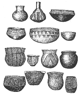
Illustration from Webb 1983:191,
courtesy of the Oklahoma Archaeological Survey.
A Bossier group of higher culture lived along Willow Chute, an old Red River channel in the valley east of Bossier City. Farming homesteads and hamlets are strung along its course and two large mounds — Vanceville and Werner — mark the Bossier ceremonial centers. Beneath the Werner mound, destroyed in the 1930s, were the ruins of an immense lodge which was circular with a projecting entrance (Webb 1983). The entire lodge measured 80 by 90 feet. It was probably ceremonial, or the lodge of a Caddi (chief), as few arrows, tools, or personal possessions were found. There were quantities of deer and other animal bones, fish and turtle bones, and mussel shells. Broken pottery in large amounts denoted feasts and the ceramics were of exceptional quality. No burials or whole vessels were found.
Each lateral lake along Red River — Black Bayou, Caddo, Wallace, Clear; and Smithport lakes on the west side; Bodcau, Bistineau, Swan, and Black lakes on the east — has Bossier period sites around its margins. Occupations continue westward to Sabine River and into eastern Texas, southward almost to Catahoula Lake, eastward along D’Arbonne and Corney bayous toward the Ouachita, and northward into Arkansas. Either late Bossier or Belcher people could have been in the populous Naguatex district described by the De Soto chroniclers, encountered just before the Spaniards crossed Red River.

Belcher Focus
The Belcher mound site, in Red River Valley about 20 miles north of Shreveport, gives its name to this Caddo culture period. Radiocarbon dates at the site and comparisons with other cultures suggest that the Belcher Focus began about A.D. 1400 and lasted into the seventeenth century. During its beginning, Belcher culture probably overlapped and coexisted with Bossier culture.
The Beicher site was excavated by Webb (1959) and his associates over a 10-year period. The Belcher mound contained a succession of levels on which houses were built, burned or deserted, and covered over with new buildings. Burials were placed in pits beneath the house floors or through the ruins of burned houses. It is inferred that the houses were ceremonial lodges or chiefs’ houses. The earliest house was rectangular; with wall posts erected in trenches and packed with clay; a 7-foot entranceway projected northeastward. The walls were clay-daubed, and the gabled roof covered with grass thatch. Later houses were circular; also with projecting entranceways, and with interior roof supports and central hearths. They also were daubed and thatch-covered, but were divided into compartments, which contained internal posts for seats or couches and sometimes small hearths for each compartment. Food remains found on the floors of Belcher houses included maize, beans, hickory nuts, persimmon seeds, pecans, mussel and snail shells, and bones of deer; rabbit, squirrel, fox, mink, birds, fish (gar; catfish, buffalo, sheeps-head, and bowfin), and turtle. Belcher tools encompassed stone celts (hatchets or chisels), arrow points which had tiny pointed stems, flint scrapers and gravers, sandstone hones, bone awls, needles and chisels, shell hoes, spoons and saws, and pottery spindle weights.
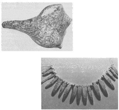
Ornaments found with burials or on house floors at Belcher include beads, anklets, pendants and gorgets of shell, pearls, ear ornaments of shell, bone and pottery, bone hairpins, bear tooth pendants, shell inlays, and small shell bangles. Some of the shell pendants were carved in lizard or salamander effigy forms. Ceremonial drinking cups made of conch shells were sometimes decorated, one bearing a composite flying serpent-eagle design. Platform and elbow pipes were of baked clay. Split cane basketry or matting fragments show herringbone or 1-over-4-under weave.
Belcher pottery was superior to that of the Bossier people and, indeed, is some of the best in the entire Caddoan area. There was a diversity of bowl, bottle, urn, jar; vase, miniature, and compound forms. Large storage ollas were found broken on house floors. Techniques of decoration involved engraving, stamping, incising, trailing, ridging, punctating, brushing, appliqué nodes, insertion of red or white pigment into designs, red slipping, polishing, pedestal elevation, rattle bowls, bird and turtle effigies, and tripod and tetrapod legs. Many of the vessels had ornate or intricate curvilinear designs, with scrolls, circles, meanders, spirals, and guilloches; sun symbols, crosses, swastikas, and triskeles were added.
Many of the 26 burials found in Beicher mound exhibited a carry-over of the early Caddo burial ceremonialism, presumably including human sacrifice. Individuals or groups of up to seven persons were placed in shaft burial pits, and often were surrounded by many pottery vessels — sometimes in stacks — in addition to tools, arrows, ornaments, food offerings, vessels with spoons, decorated drinking cups, pipes, and other indicators of high rank. As many as 20 to 40 pottery vessels had been placed in a single pit. Even small children had ornaments and numerous vessels, as though they were of the nobility. This suggests a hereditary social ranking as was found among the Natchez Indians.
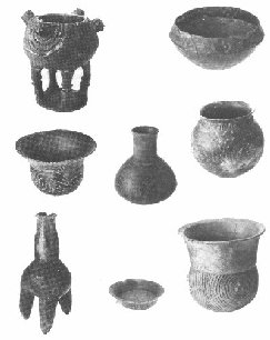
Courtesy of L.S.U. Museum of Geoscience.
Photographs by Al Godoy.
Other mound centers of Belcher culture, occurring along Red River into southwestern Arkansas, show similar ceremonialism. Villages and hamlets along the river to Natchitoches and into the uplands are marked by typical Beicher pottery sherds. In all, late Belcher people were dispersed widely, and their way of life gave rise to the generalized cultural base that existed at the time of European intrusion.

Historic Caddo
If one views the Caddoan archaeological sequence as a tree trunk, identifiable branches seem to begin spreading by about A.D. 1450 (Belcher Focus). After that point, several distinct tribal branches can be recognized, each with its own particular language, or dialect, and customs. Within relatively short distances these groups often exhibited striking differences.
The Louisiana Caddoan-speaking groups were the Adaes, Doustioni, Natchitoches, Ouachita, and Yatasi. These groups seem to have been concentrated around Natchitoches, Mansfield, Monroe, and Rebeline, Louisiana. Their total aboriginal territory stretched from the Ouachita River west to the Sabine River and south to the mouth of Cane River.
On Red River; in northeastern Texas and southwestern Arkansas, there were other Caddoan groups: Kadohadacho, Petit Caddo, Nasoni, Nanatsoho, and Upper Natchitoches. Eventually, due to pressure from the Osage, these groups migrated south to Louisiana and settled north of the Yatasi, near Caddo Prairie and Caddo Lake.
The Caddoan tribes seem to have had strong cultural affiliations. In fact, some anthropologists have considered them part of three vast intertribal confederacies (Swanton 1942; Hodge 1907). In eastern Texas another group, led by the Hasinai, consisted of the Ais, Anadarko, Hainai, Hasinai, Nabiti, Nacogdoches, and Nabedache. This group also has been considered a large confederacy (Hodge 1907).
The various peoples mentioned above seem to have been regional groups, fairly fluid in nature, but tied to general geographic boundaries. Linguistic differences served to differentiate them (Taylor 1963:51-59) and some, like the Adaes, could hardly be understood by the others. However; the Kadohadacho language dominated in the east — where nearly everyone understood it — and the Hasinai language in the west.
These groups had chiefs, or Caddi. Generally one man had more prestige than any other Caddi, but multiple chiefs — usually two — were present in most communities. Other groups seem to have had tama (local organizers), but chiefs were weak or lacking. Polity, then, consisted of the Caddi, or chiefs, and tama, a sort of organizational leader (often confused with the chief by early Europeans) who was powerful enough to gather the people for work, war, or ceremonials. The Caddi were a select group — likely the historic equivalent to the priest — chiefs of prehistoric times. Priests and witches composed a non-secular leadership among the Caddoan groups, but by historic times they had become somewhat separate from the warrior-chiefs who led the tribes.
It can been seen, then, that the Caddoan peoples had several of the criteria of true chiefdoms (Service 1962): territory, leadership, and linguistic-cultural distinctiveness. All of the Europeans — French, Spanish, and Anglo-American — who dealt with them left records relative to their character and intelligence. As late as the nineteenth century the Caddo still boasted that they had never shed white blood (Swanton 1942) and their chiefs still were respected.
In the age of tribal self-determination and Indian sovereignty, it seems in order to explain basic Caddo tribalism. Contrary to many other southeastern Indian groups, the Caddoan people seem to have clung tenaciously to land and leadership even after the erosive effects of European contact. The fact that their roots extended into prehistory gave them strength and self confidence. They kept their faith and polity, and their traditions remain even today.

European Contact
The earliest contacts with Europeans in Louisiana were fleeting. The best accounts were left by Henri de Tonti who reached a Natchitoches village in February of 1690. He was searching for the lost La Salle expedition and went on to visit the Yatasi, Kadohadacho, and Nacogdoches (Williams 1964). No other visits seem to be recorded for the next decade, even though Spanish efforts to Christianize the East Texas Caddo intensified. Contact is indicated by the 1690s in such practices as the tribes holding Spanish-style horse fairs (Gregory 1974).
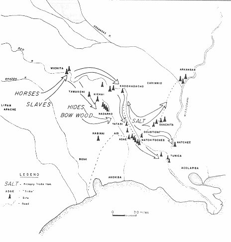
In 1701 Governor Bienville and Louis Juchereau de St. Denis, guided by the Tunica chief, Bride les Boeufs or Buffalo Tamer; arrived at the Natchitoches area. They visited the Doustioni, Natchitoches, and Yatasi villages, and then returned to New Orleans. Bienville was especially desirous of contacting the Kadohadacho to the north (Williams 1964; Rowland and Sanders 1929). This trip, ostensibly for exploration, was probably an attempt to obtain two commodities the French in lower Louisiana were desperate for: livestock and salt (Gregory 1974). The Tunica had long engaged in the Caddoan salt, and later; horse trades (Brain 1977), and like them, the Natchitoches quickly began capitalizing on their French connection. The Natchitoches employed an old Caddoan trade strategy, that of moving to the edge of another tribe’s territory, in order to be near their customers, and later returning to their own territory. Accordingly, the Natchitoches claimed a crop failure and relocated to the vicinity of Lake Pontchartrain, to trade with the French. Eventually, in 1714, they returned to Red River with St. Denis (McWilliams 1953). Likewise, the Ouachita had just moved back from the Ouachita River where they had relocated in order to trade with Tunican speakers (Gregory 1974).
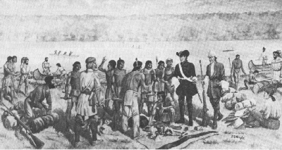
Photograph by Al Godoy
After St. Denis returned to Red River in 1714, the Caddoan people in Louisiana were to be impacted constantly by European migrants. Indian polity and and territory were eroded severely by more European settlements and the depredations of displaced populations of other Indian tribes like the Choctaw, Quapaw, and Osage.
Fort St. Jean Baptiste aux Natchitos was founded in 1714; it was the earliest European settlement in northwestern Louisiana. The East Texas missions, started in 1690, had not introduced many non-Indians to that area. The French settlements were different, however; and the Caddoan people began to see a gradual augmentation of European population. The French had, in general, good relations with the Caddo and by the 1720s a number of them had Caddoan kinsmen.
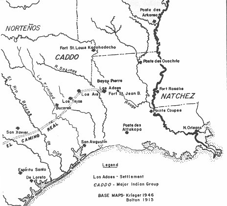
In 1723, to counter French attempts at establishing a western trade, the Spanish established an outpost, Nuestra Señora del Pilar de Los Adaes (Bolton 1914). The Spanish presidio, or fort, became a hub for clandestine traders — French, Indian, and Spanish — and lasted for some 50 years (Gregory 1974). Horses, cattle, and Lipan Apache (Connechi) slaves were traded via Los Adaes, and by the mid-eighteenth century the Spanish governors had named the site the capital of Spanish Texas.
The Caddo — Adaes, Natchitoches, Ouachita, Doustioni, and all the others — were caught between the political and economic machinations of the European powers. Gradually, the seesaw of European boundaries crossed what the Caddo all knew as their tribal territories. Traders resided in their larger communities, and seasonal hunts to the west tied them to the mercantile policies of the French and Spanish. After Louisiana was ceded to Spain at the end of the French and Indian War; French traders were left in charge of most Indian affairs in Louisiana because of the quality of their relationship to the Indians. For example, Athanase de Mezieres (Bolton 1914), St. Denis’s son-in-law, became a power on the frontier because of his close relationship to the Caddo.
Caddoan-European ties remained close until 1803 when the Louisiana Purchase brought Anglo-Americans into contact with the Caddoan groups. The Anglo-Americans had new trade and military policies, and in spite of their agreement to recognize all prior treaties between France, Spain, and Indian tribes, they were not very careful to do this. The French and Spanish had ratified land sales by tribes and had insisted that their citizens respect Caddoan land and sovereignty, but the Americans saw new lands with few settlements, and were quick to encourage white settlement. The old Caddo-French-Spanish symbiosis was ending.
The Caddoan-speaking groups began to move together by the late eighteenth century. The Kadohadacho apparently absorbed several smaller groups — Upper Natchitoches, Nanatsoho, and Nasoni — and shifted south. Osage raids had taken their toll and the Kadohadacho moved to Caddo Prairie, farther from the plains, on marginal land (Swanton 1942). They settled on the hills to the southwest of the prairie (Soda Lake) near modern Caddo Station and added their numbers to the other Red River tribes in Louisiana.
Beset by many problems, the American agents at Natchitoches began moving the agency about, trying to keep the Caddo away from white settlements. It was moved to Grand Ecore, Sulphur Fork, Caddo Prairie, and finally to Bayou Pierre about six to seven miles south of Shreveport (Williams 1964).
The Louisiana Caddoans also found themselves estranged from their cultural kinsmen in eastern Texas. First, the East Texas tribes remained under Spanish domination while their neighbors were American. Policies in Texas were quite different until the Texas Revolution and the foundation of the Republic in the 1830s and 1840s. The new Texicans refused to allow old patterns of trade and traverse for fear of having to deal with even larger Indian populations.
The Caddoan tribes were consolidated enough by 1834 that the American agents had begun to treat them as though they were a single group. The term Caddo, an abbreviated cover term for Kadohadacho, one of the larger groups, began to cover all the tribes in the American period. It was this amalgam of tribal units with which the United States decided to deal.
On June 25-26, 1835, some 489 Caddo gathered at the Caddo Agency seven or eight miles south of Shreveport on Bayou Pierre and on July 1, 1835, they agreed to sell to the United States approximately one million acres of land in the area above Texarkana, Arkansas, south to De Soto Parish, Louisiana (Swanton 1942). Two chiefs, Tarsher (Wolf) and Tsauninot, were the leaders of the Caddoan groups present at the land cession.
Present also at the land cession was their interpreter, Larkin Edwards, a man they regarded so highly that they reserved him a sizable piece of land (McClure and Howe 1937; Swanton 1942). Further; the treaty reserved a sizable block of land for the mixed Caddo-French Grappe family. Descended from a Kadohadacho woman and a French settler, Francois Grappe had served his people well. His efforts to protect not only the Caddo, but also the Bidai and others in East Texas, from American traders had resulted in his termination as chief interpreter for the American agents. The Caddoan people continued to respect and honor him.
The Caddo were to be paid $80,000, of which $30,000 was in goods delivered at the signing, and the remainder in annual $10,000 installments for another five years. Immediately Tarsher led his people into Texas and settled on the Brazos River; much to the chagrin of Texas authorities (Gullick 1921). Another group, led by Chief Cissany, stayed in Louisiana. They lived near Caddo Station in 1842 (seven years after the land cession). Texicans actually invaded the United States to insist that the Caddos disarm, the rumor in Texas being that the American agent had armed the Caddo and made incendiary remarks regarding the new republic. The Louisiana chiefs offered to go to Nacogdoches as hostages to show their good faith, but the Texicans refused them on the grounds it might mean recognition of Caddoan land rights and polity in Texas (Gullick 1921).
Eventually these Louisiana Caddo left — their credit was cut off by local merchants, their payments ended, and the United States protection was failing — and headed for the Kiamichi River country in Oklahoma. The Caddoan presence in Louisiana, after a millennium, or more, was over.
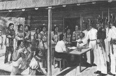
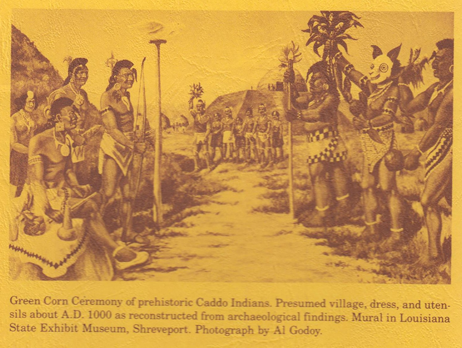
Mural in Louisiana State Exhibit Museum, Shreveport.
Photograph by Al Goody.

Caddoan Tribal Locations and Archaeology in Louisiana
One of the most difficult problems in American archaeology is the firm connection of historic tribal locations to specific material remains and sites. In recent years a number of efforts (Wyckoff 1974; Tanner 1974; Williams 1964; Gregory and Webb 1965; Neuman 1974) have dealt with this topic for the Louisiana Caddoan groups.
Again, the term Caddo has no real meaning. Each of the groups had its own political existence, and both the Spanish and French realized that. Their approach to Indian affairs has left us much better information than that of the Americans. John Sibley, the first American agent, with the aid of the half-Caddo, Francois Grappe, gave us good information, but through time the American policy increasingly obscured tribal groups. By the time of the 1835 land cession the Americans were talking merely of the Caddo Nation. In the 1835 Treaty not a single warrior was identified by tribe, nor were the chiefs (Swanton 1942); this was a purely political machination by the Americans.
Since the early American policy has obscured the tribal diversity and history of the Caddoan groups in Louisiana, it seems in order to return to the older practice of recognizing the individual groups. Each will be discussed briefly, in turn, and archaeological sites will be related where possible. As was the practice in French and Spanish days, the tribes will be discussed from southernmost to northernmost, as they would be encountered as one ascended the Red River.

The Natchitoches
The Natchitoches, or “Place of the Paw-Paw” (all translations by Melford Williams, personal communication, 1973), sometimes simply stated as the “Paw-Paw People,” were the southernmost Caddoan group. They had absorbed the Ouachita (“Cow River People”) by 1690 (Gregory 1974) and will be treated as a single group here.
The Natchitoches lived in a series of small hamlets, each with its own cemetery and cornfields. One hamlet had a temple which was described by Tonti (Walker 1935) and their whole settlement stretched from about Bermuda, Louisiana, to the vicinity of Natchitoches. Throughout their early history they remained in the alluvial valley of the Red River where only a few areas, usually “islands” of older terraces, were above the active floodplain. Wyckoff (1974) has stated that they preferred the tupelo gum-bald cypress biotic zone along the Red River; but in reality they seem to have lived on the mixed hardwood, cane-covered natural levees or in the oak-hickory ecological communities found on higher ground.
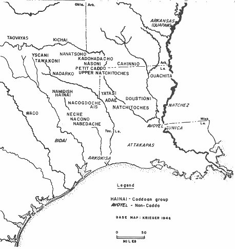
Natchitoches chiefs’ names are scarce, and one gets the impression that their chiefs were not very powerful. However, St Denis seems to have purchased property from a chief called the White Chief. It can be assumed that the tribes all had Caddi, tama, and priests. However, it seems that there were more egalitarian structures among the Natchitoches, Adaes, and Yatasi than in the East Texas or Great Bend groups.
Documents indicate that at least four sites were occupied by the Natchitoches between 1690 and 1803: White Chief’s village, Captain’s village (Pintado Papers), La Piniere village (Bridges and Deville 1967:239), and Lac des Muire village (Sibley 1832, 1922). There are a larger number of archaeological sites which have yielded Natchitoches Engraved, Keno Trailed, or Emory Incised ceramic vessels or sherds, catlinite pipes, glass trade beads, copper or brass objects, knives, and gun parts. These include the U.S. Fish Hatchery (Walker 1935), the Lawton (Webb 1945), the Southern Compress (Gregory and Webb 1965), Natchitoches Country Club, Chamard House, American Cemetery, Settle’s Camp, and Kenny Place sites (Gregory 1974).
The Southern Compress and American Cemetery sites seem to correspond to White Chief’s villages. The Fish Hatchery and Kenny Place sites are likely combinations of Ouachita and Natchitoches groups visited by Canard and others. Settle’s Camp site and Country Club site are along the high hills west of the modern town of Natchitoches and may well be the dispersed settlement known as La Pinière, (the Piney Woods) to the French. Chamard House site may have belonged to the French trader Chamard, or possibly one of the Grappes; located on the bluff overlooking the active Red River, it remains undocumented.
The Lawton site was the site seized for debts from the son of the Christian Indian, known as Pierre Captain, probably a sub-chief or possibly a tama, of the Natchitoches (Pintado Papers:139). The latest Natchitoches village, Lac des Muire, was north of Powhatan and on the west bank of the Red River. Sibley (1922) pointed out that although the tribe was reduced in number they retained their language and distinctive dress. They were farmers and lived in houses, presumably their traditional wattle-daub constructions.
Natchitoches land was gradually surrounded by Anglo-Americans and, by the time of the Caddo Treaty, Natchitoches was a thriving community. The tribe lived north of the town, near the Grappes (their cultural broker with the whites). Local tradition holds that they were loaded on a steamboat on the Front Street dock and taken to Oklahoma in 1835 — something that obviously did not happen. In 1843 the tribe was still together under Chief Cho-wee (The Bow) and living near the Kadohadacho on the Trinity River in Texas (Swanton 1942:96).
In the 1960s Caddos living near Anadarko, Oklahoma, still could sing a few Natchitoches songs (Claude Medford, Jr., personal communication, 1975) and the late Mrs. Sadie Weller recorded in that language. Most contemporary Caddo remember the tribal name and a few “old” words, but as a distinct group the Natchitoches seem to have been absorbed by the Kadohadacho and Hasinai.

The Adaes
The Adaes (from Nadai which meant “A Place Along a Stream”) were supposed to have had a village on Red River, near the Natchitoches. If their reported village is taken to mean a dispersed series of kin-based hamlets — what Spanish colonial people called rancherias — the previously described Chamard site may be it.
In the 1720s the Spanish established a mission for the Adaes, but its priest and one lay-soldier were expelled by the French lieutenant, Blondel (Bolton 1921). At the time there were no Indians living at the mission. Apparently, they relocated nearer the Spanish, but conversions were rare, and the Adaes were more interested in trade than religion. So, for that matter, were the Spanish, and when the presidio (now called Los Adaes) was established in 1723, ostensibly to protect the mission, the Adaes seem to have lived all around the vicinity.
Los Adaes then became essentially an Indian dominated community: Lipan, Coahuiltecans, Adaes, Wichita, Tawakoni, and others lived there off and on. Even the commandant, Gil Ybarbo, was married to a mestiza, a half-Indian woman. Whenever the Spanish authorities in Texas needed translators for Caddoan languages, they set for soldiers from Los Adaes (Blake Papers).
There was an Adaes village near Big Hill Firetower at a place called La Gran Montafla (Bolton 1962) which has never been found, and another nineteenth century village on Lac Macdon. The latter is probably a later village than the one known on Spanish Lake where burials with European goods were excavated by James A. Ford (1936, unpublished fieldnotes, Museum of Geoscience, Louisiana State University).
Tayler (1963:51-59) finally placed Adaes as a definite Caddoan language, but it was the most deviant of all (Sibley 1832), and the Adaes became more and more western in their cultural orientation (Gregory 1974). They gradually extended to the Sabine River where a late trash pit (A.D. 1740) at Coral Snake Mound may be evidence of their presence (McClurken, Field and Woodall 1966). It contained glass trade beads, and a French musket lock was found nearby. Their Lac Macdon village, where they remained as late as 1820, was probably near the water body known today as Berry Brake and may well be on Allen Plantation.
Little is known of Adaes history or culture. De Mezieres (Bolton 1914:173) noted that they were severely impacted by Europeans and “extremely given to the vice of drunkenness” Like the Natchitoches, they seem to have had close relationships with the Yatasi who were sometimes called the Nadas, likely a homonym for Nadais.
One Adaes chief who was their leader in the 1770s has been identified and they are clearly an archaeologically distinct group. Gregory (1974) has pointed out the higher frequencies of bone-tempered pottery and the ceramic types Patton Engraved and Emory Incised from trash pits at Los Adaes.
Unlike the Natchitoches and others, the Adaes are not remembered by contemporary Caddo who may have heard of them merely as part of the Yatasi, who are remembered as a group. Many may have been absorbed, as Christians, into the general mestizo population at Los Adaes and still have descendents in northwestern Louisiana.

The Doustioni
Swanton (1942) translates Doustioni as “Salt People,” and they seem to have lived near the salines northeast of Natchitoches. Little else is known about them, and they do not seem to persist into the nineteenth century. They either disappeared or mingled with the Natchitoches.
A large village site, on Little Cedar Lick, has yielded shell-tempered sherds, Venetian glass beads, and French faience, all early to middle eighteenth century artifact types. The site probably was the major Doustioni settlement. Other evidence of late occupations appears at Drake’s Lick. Williams (1964) points out that the Doustioni once had a village below the Natchitoches, and, though it has not been located, it may have been near the confluence of Saline Bayou and Red River, somewhere below Clarence, Louisiana. Saline Bayou provides easy access to the salt licks and was described by several early travelers (Le Page du Pratz 1774).

The Ouachita
The Ouachita were living on the river of that name before 1690. The most likely site is Pargoud Landing at Monroe where recent excavations have yielded early trade beads but no other goods (Lorraine Heartfield, personal communication, 1977). Other sites considered for the historic Ouachita were the Keno and Glendora sites (Gregory 1974; Williams 1964), but these are not certain since they may represent a Koroa (Thnica) village with Caddoan trade connections or vice versa. However, animal burials and grave arrangements show that these sites are closer culturally to the Red River sites than to other sites on the Ouachita. Gregory (1974) has discussed the Moon Lake and Ransom sites north-east of Monroe as possible Ouachita sites, but these may have been earlier Koroa sites also.
As was discussed earlier, the Ouachita fused with the Natchitoches, likely at or near the U.S. Fish Hatchery site, which revealed their ceramic styles and animal burials. Fish Hatchery was a very early French contact site (Gregory and Webb 1965; Gregory 1974), and it is the only historic Caddo site to share deliberate burial of animals (horses) with the Ouachita River sites. The Ouachita apparently were absorbed completely before the 1720s.

The Yatasi
The name Yatasi, meaning simply “Those Other People” in Kadohadacho language (Melford Williams, personal communication, 1977) apparently was applied to a number of groups living in the hills north of the Adaes and south of Caddo Lake. At least three villages are attributed to them historically. One, located near Mansfield on Bayou Pierre in the Red River Valley north of Natchitoches, was large enough to have a resident trader (Bolton 1914). The Pintado Papers also refer to a group and their chief, Antoine, who were living on a prairie known as Nabutscahe near Mansfield as late as 1784. Another village was located near LaPointe on Bayou Pierre (American State Papers 1859), and a third was near the Sabine River close to modern Logansport (Darby 1816).
As was pointed out, the Adaes and Yatasi apparently were fairly closely related, and they may not have been real tribes, but rather a series of kin-linked bands, each with its own autonomy. The Caddoan term for these groups sounds much like a more inclusive term which lumps small, scattered groups. Whether their “chiefs” were really chiefs or local, heuristic leaders remains problematical. Bolton (1914) mentions chiefs, stating that Athanase de Me zie res gave peace medals to two chiefs, Cocay and Gunkan, in 1768.
Presently, the archaeological picture seems to support the hypothesis that the Yatasi included a number of small autonomous bands. A cluster of sites is located around Chamard Lake: the Arnold or Bead Hill site (Gregory and Webb 1965), the Wilkinson site (Ford 1936), and the Eagle Brake site (Gregory 1974). These sites have fairly large, deep middens and all have yielded Natchitoches Engraved sherds and trade goods. This is somewhat different from the scattered shallow sites nearer Natchitoches and suggests more clustered populations, but still a dispersed settlement pattern. None of these archaeological sites seems to correspond to the Red River-Bayou Pierre sites, though they shared the drainage. Although it is known that the Lafittes, Poisot, and Rambin claims were near the Yatasi villages, and all of these settlers traded with the tribe (Pintado Papers:82-84), their documented sites remain to be found.
Contemporary Caddo, most of whom are Kadohadacho or Hasinai, frequently mention the Yatasi when asked about other groups and know they once existed. However, it remains obscure whether the Yatasi were one or many little groups. They seem to have been absorbed by the Kadohadacho, but it is hard to trace them after the American land sales.

The Kadohadacho
The Kadohadacho (“Great Chiefs” in the Caddoan languages) were the dominant Caddoan-speaking group in the Red River Valley. They occupied a widely dispersed settlement with a temple and a mound, in northeastern Texas and probably near the Great Bend at Texarkana. The Petit Caddo, Nasoni, Nanatsoho, and Upper Natchitoches were absorbed by the Kadohadacho, and the tribes abandoned their Great Bend villages (at least four archaeological sites there seem related to these groups) and shifted south to Caddo Lake. Once there, their chief, Tinhiouen, dealt politically with both the Spanish (Bolton 1914) and the Americans.
The Kadohadacho language was the most widely understood of all the Caddoan tongues, and, according to early accounts (Sibley 1922), the tribe was the most influential of all the Caddos. They had a sort of warrior class comparable to the “Knights of Malta.” It is, therefore, not surprising that the Kadohadacho became the Caddo Nation of the American period (Williams 1964).
The Kadohadacho settled, at least by 1797 (Swanton 1942), at a location known as Timber Hill (Mooney 1896:323) near Caddo Lake (Swanton 1942). Williams (1964) has pointed out that this village has never been located archaeologically. However, it should be noted that the Texicans placed the tribe near Caddo Station in 1842 (Gullick 1921).
Immediately after the American land treaty, the tribe apparently split into factions. A group under Thrsher moved to the Brazos River in Texas; the others stayed in Louisiana until at least 1842, when they apparently moved to live with the Choctaw sometime that year (Swanton 1942:95).
The late Miss Caroline Dormon (1935, unpublished field notes, Special Collections, Eugene Watson Library, Northwestern State University) recorded a single burial, with a “silver crown, copper, etc.,” which was found near Stormy Point on Ferry Lake by James Shenich, son-in-law of Larkin Edwards. This burial may have been very near the Kadohadacho village. According to the Dormon notes, this was a favorite crossing to Shreveport and the Indian trace was visible as late as the 1860s. In spite of the fact that “Glendora Focus” artifacts were not present (Williams 1964), it can no longer be said that there were no historic Caddoan sites in the Treaty Cession areas of De Soto and Caddo parishes. In fact there is a good possibility that this was the grave of the powerful chief, Dahaut, who died in 1833 (Caddo Agency Letters).

Caddoan Heritage
The Caddo left their names, art, and culture in Louisiana. A number
of colonial European families can boast of Caddoan ancestors:
Grappes, Brevelles, Balthazars, and others. In Oklahoma, after years of
wandering, the Kadohadacho and Hasinai have become the dominant
groups. Yet, as has been pointed out, old traditions persist. Poople still
recall stories of floods on Caddo Prairie which left cows hanging by their
horns in the trees, and know that Natchitoches meant the place of “little
yellow fruits” that do not grow in Oklahoma.
At Binger and near Hinton, Oklahoma, the old songs and dances
continue to be heard and seen. The Turkey Dance still is held before the
sun sets, and individuals sing the “Dawn Song” or “The Cat Song” on
their way home from the dancing.
The Caddo now visit Louisiana, especially Natchitoches and
Shreveport, to see the places of their tradition. Places are part of Indian
tradition and pilgrimages are sacred acts. Perhaps now other Louisianians
will join the Caddo who realize how much Indian culture remains in
northwestern Louisiana.

References Cited
American State Papers-
1859 Documents of the Congress of the United States in relation to
the Public Lands, Class VIII, Public Lands (Vol.3). Washington, D.C.
-
1939 Translations of the Spanish records of Nacogdoches County,
Texas. Ms. on file, Special Collections Library, Stephen F. Austin University, Nacogdoches.
-
1914 Athanase de Mezieres and the Louisiana-Texas frontier; 1768-1780. Arthur H. Clark, Cleveland.
1921 The Spanish borderlands. Yale University Press, New Haven.
1962 Texas in the middle eighteenth century. Russell and Russell, New York.
-
1977 On the Thnica trail. Louisiana Archaeological Survey and
Antiquities Commission, Anthropological Study 1.
-
1967 Natchitoches and the trail to the Rio Grande: two eighteenth
century accounts by the Sieur Derbanne. Louisiana History
8:239-247.
-
1819-1835 Correspondence of George Gray and Jehiel Brooks. Microfilm. National Archives, Washington, D.C.
-
1816 A geographical description of the State of Louisiana. John
Melish, Philadelphia.
-
1936 Analysis of Indian village site collections from Louisiana and
Mississippi. Department of Conservation, Louisiana Geological
Survey, Anthropological Study 2.
-
1953 The Bellevue mound: a pre-Caddoan site in Bossier Parish,
Louisiana. Bulletin of the Texas Archeological Society 24:18-42.
-
1965 A preliminary survey of Paleo-Indian points from Louisiana.
Louisiana Studies 4(1):62-77.
-
1974 Eighteenth century Caddoan archaeology: a study in models
and interpretation. Unpublished Ph.D. thesis, Department of
Anthropology, Southern Methodist University, Dallas.
-
1965 European trade beads from six sites in Natchitoches Parish,
Louisiana. Florida Anthropologist 18(3): 1544.
-
1921 Papers of Mirabeau Lamar (6 vols.) A. C. Baldwin and Sons,
Austin.
-
1907 Caddo. In Handbook of American Indians north of Mexico.
Bureau of American Ethnology, Bulletin 30, Part 1.
-
1774
The history of Louisiana. English translation published by T.
Becket, London. (Original: Histoire de la Louisiane, Paris
1758).
-
1937 History of Shreveport and Shreveport builders. J. Ed Howe,
Shreveport.
-
1966 Excavations in Toledo Bend Reservoir, 1964-65. Papers of the
Texas Archeological Salvage Project 8, Austin.
-
1953 Fleur de lys and calumet: being the Penicaut narrative of
French adventure in Louisiana. Louisiana State University
Press, Baton Rouge.
-
1896 The ghost-dance religion and the Sioux outbreak of 1890.14th
Annual Report of the Bureau of American Ethnology,
1892-1893, Part 2.
-
1912 Some aboriginal sites on Red River. Journal of the Academy of
Natural Sciences of Philadephia 14:482-644.
-
1974 Historic locations of certain Caddoan tribes. In Caddoan
Indians II, pp, 9-147. Garland, New York.
-
n.d. Land claim documents, State of Louisiana. Ms. on file,
Louisiana State Land Office, Baton Rouge.
-
1929 Mississippi provincial archives, 1701-1729. Mississippi
Department of Archives and History, Jackson.
-
1962 Primitive social organization. Random House, New York.
-
1832 Historical sketches of the several Indian tribes in Louisiana,
south of the Arkansas River, and between the Mississippi and
Rio Grande. American State Papers, Class II, Indian Affairs
(Vol.1), pp.721-731, Washington, D.C.
1922 A report from Natchitoches in 1807, edited by Annie Heloise Abel. Museum of the American Indian, Heye Foundation, Indian Notes and Monographs, Miscellaneous Series 25:5-102.
-
1942 Source material on the history and ethnology of the Caddo
Indians. Bureau of American Ethnology, Bulletin 132.
-
1974 The territory of the Caddo Tribe of Oklahoma. In Caddoan
Indians IV, pp.1-67. Garland, New York.
-
1963 The classification of the Caddoan languages. Proceedings of
the American Philosophical Society 107(1 ):5 1-59.
-
1980 The Hanna site: an Alto village in Red River Parish. Louisiana
Archaeology 5.
-
1935 A Caddo burial site at Natchitoches, Louisiana. Smithsonian
Miscellaneous Collections 94(14).
-
1945 A second historic Caddo site at Natchitoches, Louisiana.
Bulletin of the Texas Archeological and Paleontological Society
16:52-83.
1946 Two unusual types of chipped stone artifacts from northwest Louisiana. Bulletin of the Texas Archeological and Paleontological Society 17:9-17.
1948a Caddoan prehistory: the Bossier Focus. Bulletin of the Texas Archeological and Paleontological Society 19:100-147.
1948b Evidences of pre-pottery cultures in Louisiana. American Antiquity 13(3):227-232.
1959 The Belcher mound: a stratified Caddoan site in Caddo Parish, Louisiana. Memoirs of the Society for American Archaeology 16.
1963 The Smithport Landing site: an Alto Focus component in De Soto Parish, Louisiana. Bulletin of the Texas Archeological Society 34:143-187.
1983 The Bossier Focus revisited: Montgomery I, Werner and other unicomponent sites. In Southeastern Natives and their pasts: papers honoring Dr. Robert E. Bell, edited by Don G. Wyckoff and Jack L. Hofman, pp. 183-240. Oklahoma Archeological Survey Studies in Oklahoma’ Past 11; Cross Timbers Heritage Association Contribution 2. Oklahoma Archeological Survey, The University of Oklahoma, Norman.
-
1939 Further excavations of the Gahagan mound; connections with
a Florida culture. Bulletin of the Texas Archeological and
Paleontological Society 11:92-126.
-
1977 The Springhill Airport sites, J. C. Montgomery I (16WE32)
and II (16WE33). Newsletter of the Louisiana Archaeological
Society 4(3):3-7.
-
1975 Mounds Plantation (16CD12), Caddo Parish, Louisiana. Louisana Archaeology 2:39-127.
-
1971 The John Pearce site (16CD56): a San Patrice site in Caddo
Parish, Louisiana. Bulletin of the Texas Archeological Society
42:1-49.
-
1964 The aboriginal location of the Kadohadacho and related tribes.
In Explorations in Cultural Anthropology, edited by Ward H.
Goodenough, pp.545-570. McGraw-Hill, New York.
-
1974 The Caddoan cultural area: an archaeological perspective. In
Caddoan Indians, I, pp.6-16. Garland, New York.
Text prepared by:
- Bruce R. Magee
Source
Webb, Clarence H., and Hiram F. Gregory. The Caddo Indians of Louisiana. 2nd ed. Baton Rouge: Dept. of Culture, Recreation, and Tourism, 1990. Louisiana Archaeological Survey and Antiquities Commission, No. 2. Louisiana Office of Lt. Governor. Web. 29 May 2020. <https:// www.crt.state. la.us/ dataprojects/ archaeology/ virtualbooks/ CADDO/ caddo.htm>.
